
Narangala Mountain: A Hidden Gem for Hikers and Campers
The Golden Peak of Sri Lanka
Introduction
Sri Lanka, the island country famous for its verdant scenery and spectacular topography, is blessed with numerous impressive mountains and trekking points. Narangala, a notable peak in the Uva Province, is one such destination that is not only a place of natural beauty but also of cultural significance and ecological importance. Its golden grasslands, vistas, and spiritual importance make Narangala more than a trekking point it’s a testament to the coexistence of nature and tradition in Sri Lanka.
Location and Geography
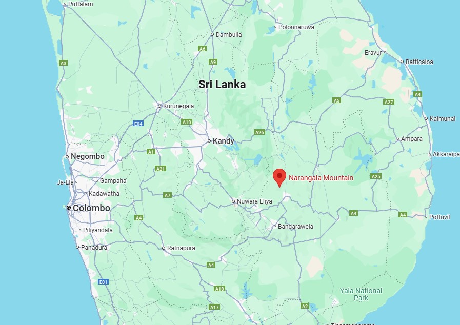
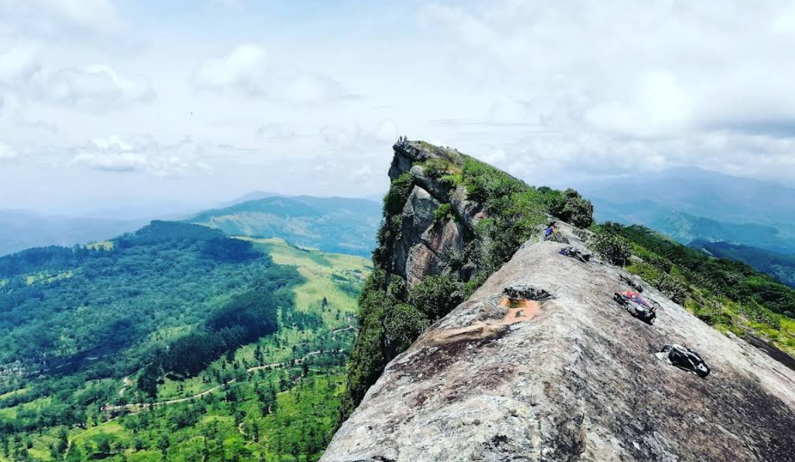
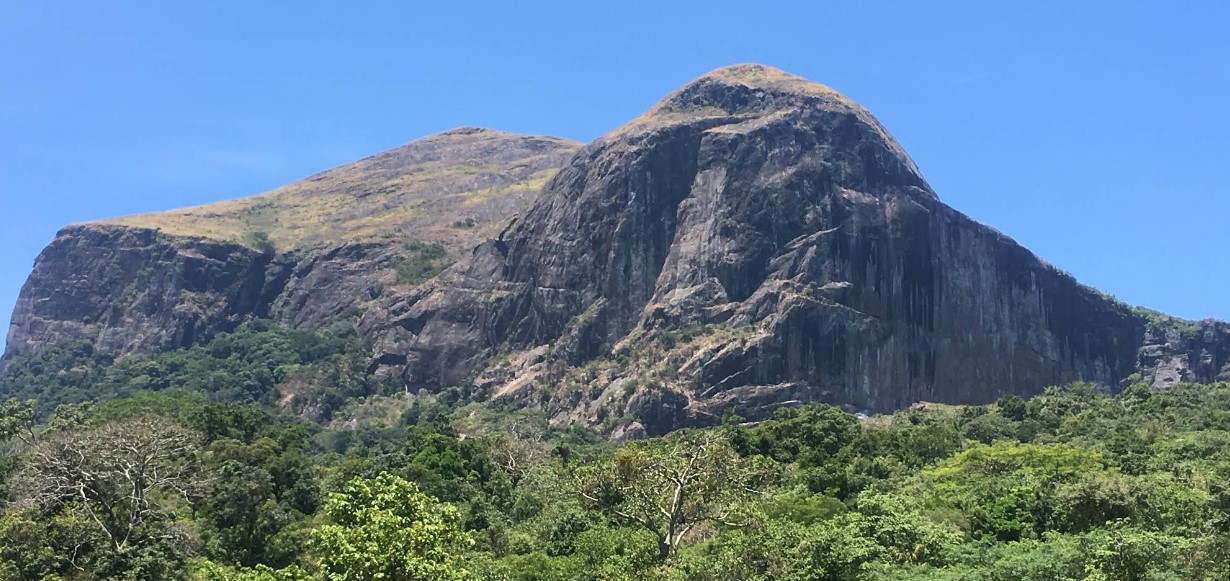
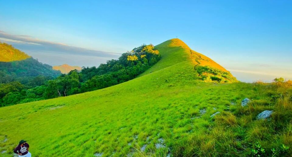
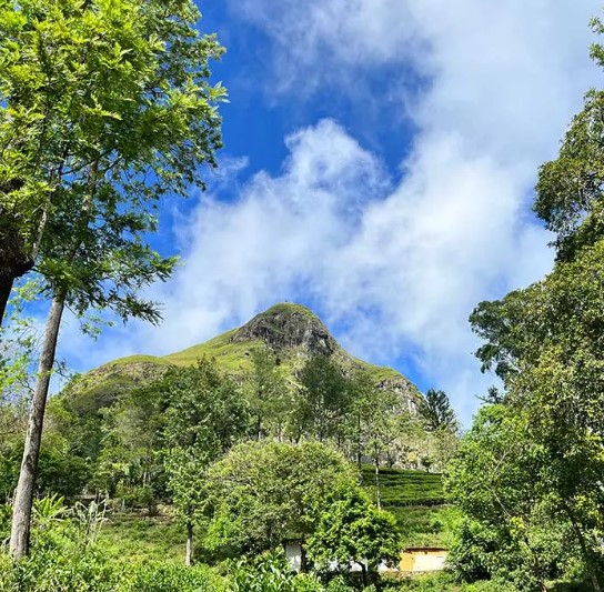
Narangala is located in the Badulla District, in the middle of Uva Province. It stands at approximately 1,527 meters (5,010 feet) above sea level and is the second-highest mountain in the province after Namunukula. The summit is visible from afar due to its distinctive golden hue, especially during the dry season when the tall grasses covering its slopes turn yellowish-brown, earning it the nickname “The Golden Peak.”
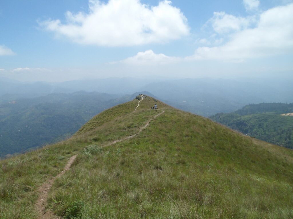
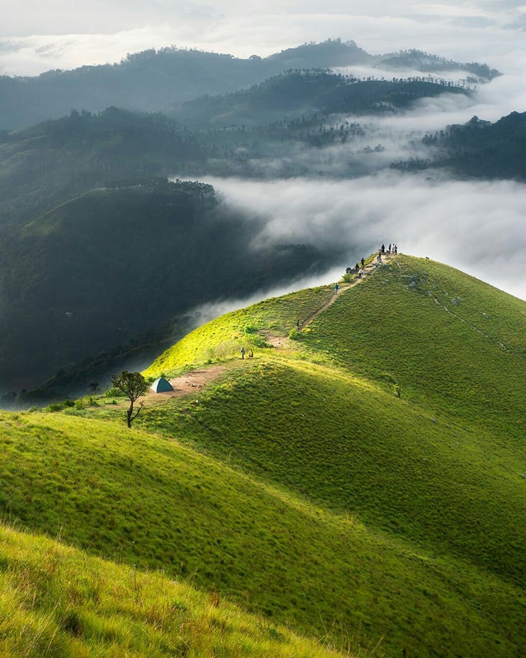
The landscape of Narangala offers 360-degree panoramic views of the valleys, tea estates, and forests below. On a clear day, the Namunukula mountain range, Horton Plains, Pidurutalagala, and even the Eastern Province are visible. The peak is generally shrouded in mist in the mornings, creating an ethereal and serene gloom.
Historical and Cultural Significance
Narangala is not just a geographical formation it holds immense historical and religious importance. It is the local tradition that Lord Buddha desired to place his sacred footprint on Narangala during his legendary visit to Sri Lanka. But, observing local people engaged in agriculture and cattle keeping, he chose to leave his footprint at Sri Pada (Adam’s Peak) since it was spiritually more suitable.
The mountain is also involved in Sri Lankan royal and colonial history. According to the chronicles, in the 1st century BC, King Walagamba, who had escaped to the Uva area during an Indian invasion, is said to have utilized the forests of Narangala as a hiding place. He subsequently ordered an underground tunnel system which is thought to link the Bogoda Raja Maha Viharaya and Dowa Temple, with sections of the tunnel said to pass under the Narangala range.
Narangala served as a base during the Uva-Wellassa uprising in the 19th century against British colonists. Its mountainous terrain offered natural protection to freedom fighters like Keppetipola Disawe and his troops. All these have placed Narangala firmly not just in the landscape, but in the nation’s collective consciousness.
Ecological Significance
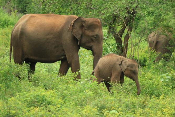
The ecological diversity of Narangala is equally stunning. The lower slopes of the mountain are covered in dense montane forest, while the upper slopes are covered in open grasslands. This mixture of ecosystems supports a tremendous variety of plant and animal life. There are endemic bird species, butterflies, reptiles, and small mammals to be found here, and therefore it is an important location for biodiversity conservation.
It is also a source of freshwater streams and ponds that sustain wildlife as well as locals. The mountain plays a crucial role in maintaining the ecological balance of the area, such as the preservation of the Mahiyangana and Badulu Oya river basins that depend on water from these highlands.
Trekking and Adventure
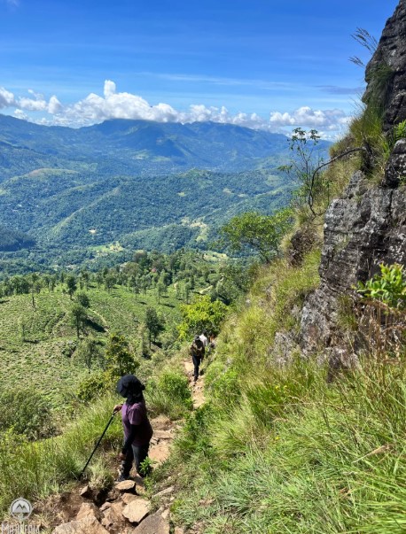
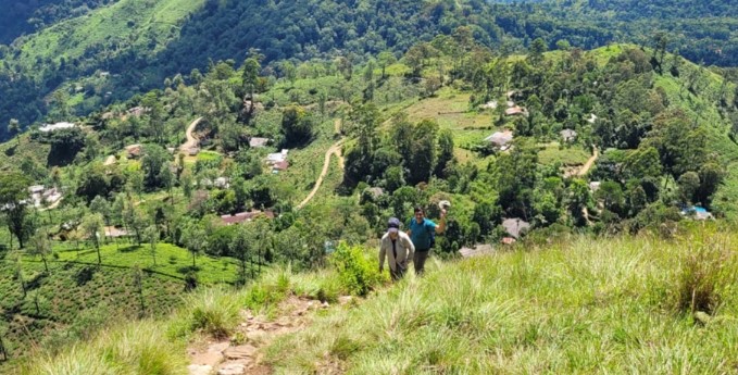
Trekking and camping are two of the most in-demand activities people undertake in Narangala. The trek trail begins close to Thangamale Tea Estate, and the ascent to the summit is roughly 6 kilometers. It normally takes 2 to 3 hours for a trekker to reach the top, based on climatic conditions and the route followed.
The trail is steep and possibly slippery, especially during monsoon season. The hike is rewarding, however trekkers walk through tea plantations, pine woods, and open meadows. The final climb is relatively gentle, to a broad, grassy summit ideal for camping.
Summit camping is a favorite with many. The clear night skies are perfect for stargazing, and the sunrise at the summit is absolutely breathtaking. The mountain summit is relatively flat and therefore a safe and scenic place to pitch tents.
Spiritual and Meditative Experience
The majority of local trekkers call Narangala a spiritual retreat. The peacefulness of the surroundings and the quietness of the peak offer a place for meditation, reflection, and rejuvenation. Small Buddhist shrines both near the base and the top of the mountain suggest that the mountain has been a place of pilgrimage and prayer for centuries.
There are even overnight pirith chanting ceremonies and almsgiving ceremonies conducted at the peak by certain trekkers as acts of merit. These spiritual activities are indicative of how deeply Narangala is ingrained in the Buddhist cultural tradition of the region.
Community and Local Culture
The surrounding villages of Narangala, such as Galahitiyaya, Meegahakiula, and Madolsima, have flourishing tea worker and farmer communities. Tea plantations, vegetable cultivation, and now eco-tourism are the pillars of the local economy.
Travelers to Narangala usually visit local tea shops or village houses for refreshments. This patronage benefits the community economically and provides tourists with a more genuine Sri Lankan experience. Local guides and homestay providers are becoming more involved in sustainable tourism, which helps maintain the area for generations to come.
Challenges and Conservation
Despite all its beauty and importance, Narangala is not without problems. Excessive tourism, litter and campfire marks have threatened its fragile environments. Sections of the track have been eroded by the heavy volume of users and rain. Illegal logging within the surrounding forests has also been reported.
In response to such threats, awareness campaigns have been initiated by local conservationist organizations and the Forest Department. Some of the dos proposed to conserve the mountain are hiking responsibly, carrying back waste, and avoiding loud music or fires.
Location Overview:
Narangala is located in the Badulla District, Uva Province. It’s approximately 20 km from Badulla town and close to Meegahakiula and Keenakele villages.
How to Get to Narangala
From Colombo:
Route 1 – By Car or Private Vehicle:
- Take the Colombo – Kandy (A1) highway.
- Continue on Kandy – Mahiyangana – Badulla road (A26).
- After reaching Badulla, head toward Meegahakiula and then to Keenakele.
- The trailhead is near Keenakele or Thangamale Tea Estate.
Travel Time: ~6–7 hours
Distance: ~220 km
By Bus or Train:
Option 1: Colombo to Badulla by Train
- Take the Badulla-bound train from Fort Railway Station (one of the most scenic train routes in the world).
- From Badulla Railway Station, take a bus or tuk-tuk to Meegahakiula – Keenakele.
Train Duration: 9–10 hours
Reserve 1st or 2nd class for comfort.
Option 2: Bus
- Take a bus from Colombo to Badulla (CTB or private).
- From Badulla town, take a local bus to Meegahakiula (about 1 hour).
- From there, get a tuk-tuk or van to the Narangala trailhead.
Hiking to the Summit:
- The hike begins near Keenakele or Thangamale Tea Estate.
- Hiking distance: ~6 km (moderate to steep in parts).
- Duration: 2–3 hours to reach the summit.
Tips:
- Start early morning to enjoy sunrise or camp overnight.
- Bring water, snacks, warm clothes, and a tent if camping.
- Avoid hiking alone and consider a local guide if unfamiliar.
Map of Narangala Mountain