
Katusu Konda: Edge of Adventure Lizard’s Back
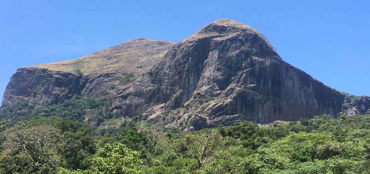
Katusu Konda is a peak in the Hanthana Mountain Range in Kandy. Katusu Konda Peak, or the Knife-edge Peak, is a popular choice among extreme trekkers. It is one of the peaks of the main Hanthana Mountain Range in Kandy, Sri Lanka. The path to this peak is very challenging and quite adventurous for anyone. One can witness stunning views uphill and observe a very exquisite ecosystem with lovely flora and fauna.
What is Katusu Konda and Where is it Located?
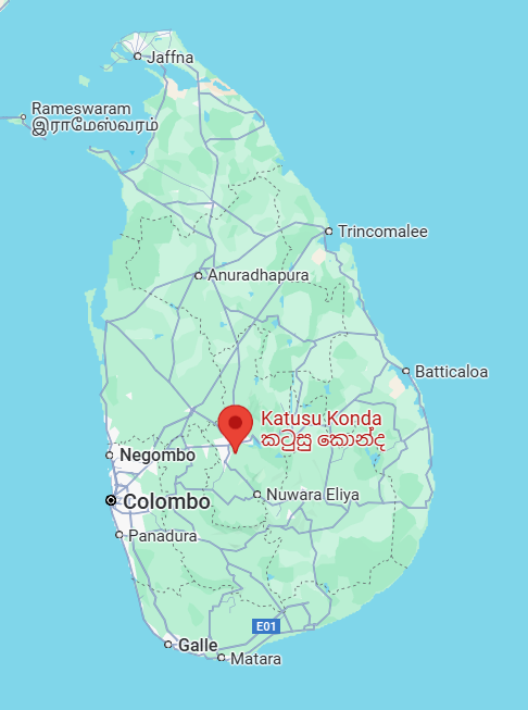
Katusu Konda is one of the most frequented mountain peaks in the famous Hanthana Mountain Range in Kandy, Sri Lanka. It is situated about 74 miles from the East of Colombo and about 9 miles away from the central city of Kandy.
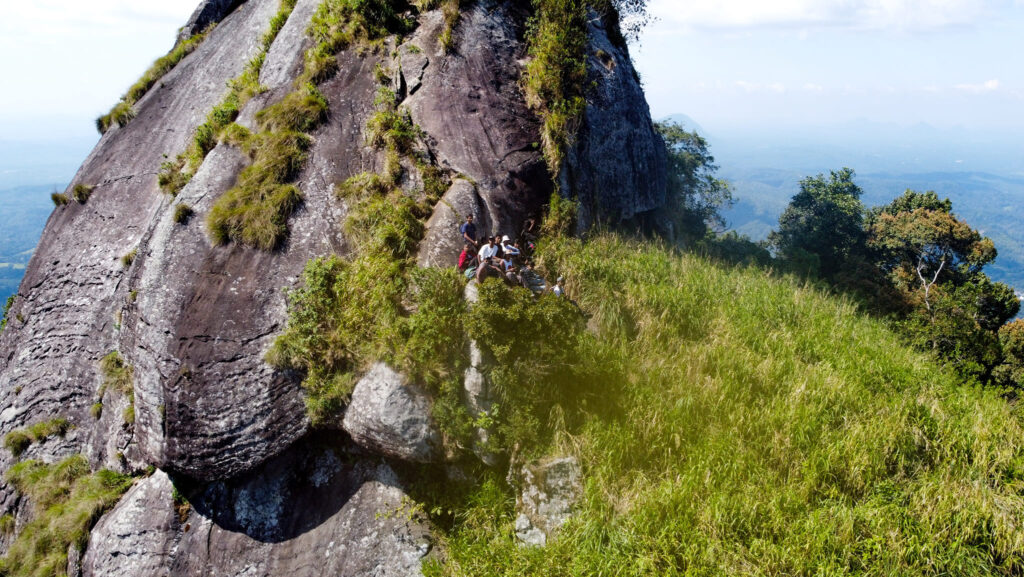
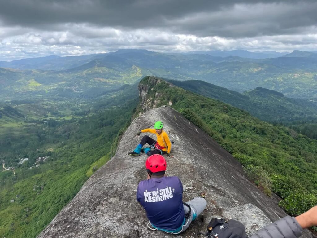
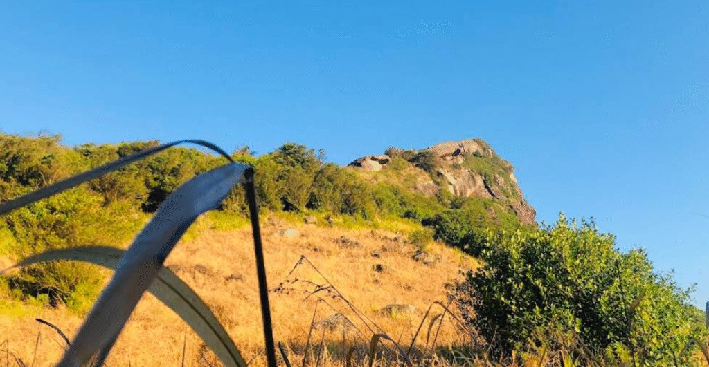
Katusu Konda is also known as Knife-edge peak and the name “Katusu Konda” in Sinhala literally translates to “Lizard backbone” because the peak top resembles a backbone of a lizard. The high peak is becoming more popular as one of the most sought-after destinations by hike lovers because it requires a lot of adventure and excitement.
Katusu Konda Peak: how to get there
It is not difficult to access Katusu Konda Peak if you are already in Kandy. However, we shall walk you through the complete guide on how to get to the summit when you travel straight from Colombo and if you happen to be in Kandy.
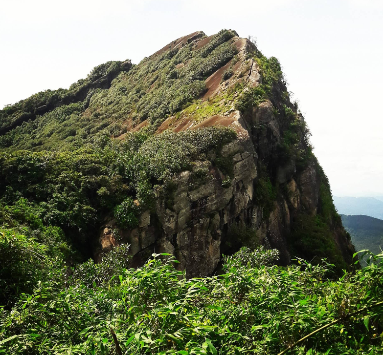
What Kind of Experience Can You Get In Katusu Konda Peak?
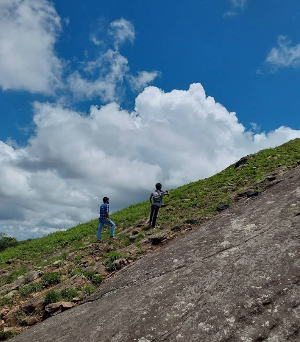
Your journey to Katusu Konda is just a thrill, adventure, and pure adrenaline rush from beginning to end. There is no trail as such to climb to the summit but you can observe a tiny pathway created by the trekkers who had come here before.
The Hike Begins…
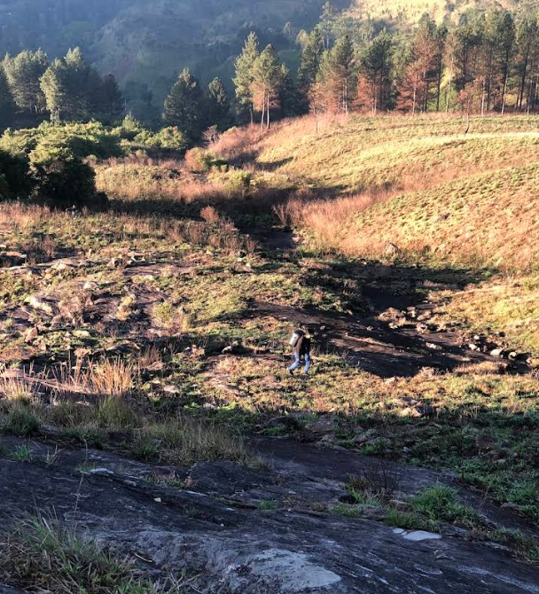
The hike begins from the point where you enter the Hanthana Mountain Range from the Upland Estate. There aren’t any particular routes but you’ll be able to find a fairly visible pathway amidst the thick bushes. The only things that you’ll be able to view around you are hills, high trees, rocks, and foliage.
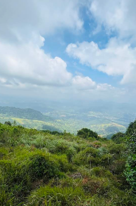
The beginning itself is not that tough but the trail gets steeper and steeper as you ascend. Amidst the panoramic view, your eyes will feast on lovely hillside flowers and peculiar trees, vines, plants, bushes, etc. The natural landscape of big and small rocks will give you more adventure in your trek. You can drop by, take a glance at the picturesque environs around, take photos, and proceed at your own pace.
Be Ready To Be Astonished At The Top!
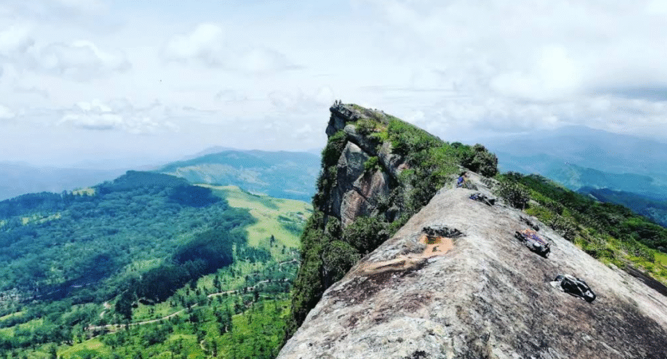
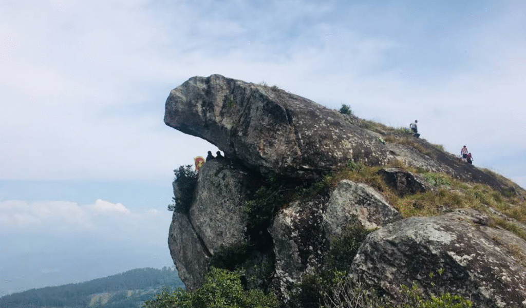
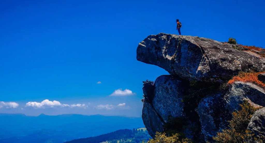
The tiresome trek you did all along just gets dissipated the instant you reach the destination. The 360-degree view of the surroundings is stunning and it is definitely a once-in-a-lifetime experience one can have.
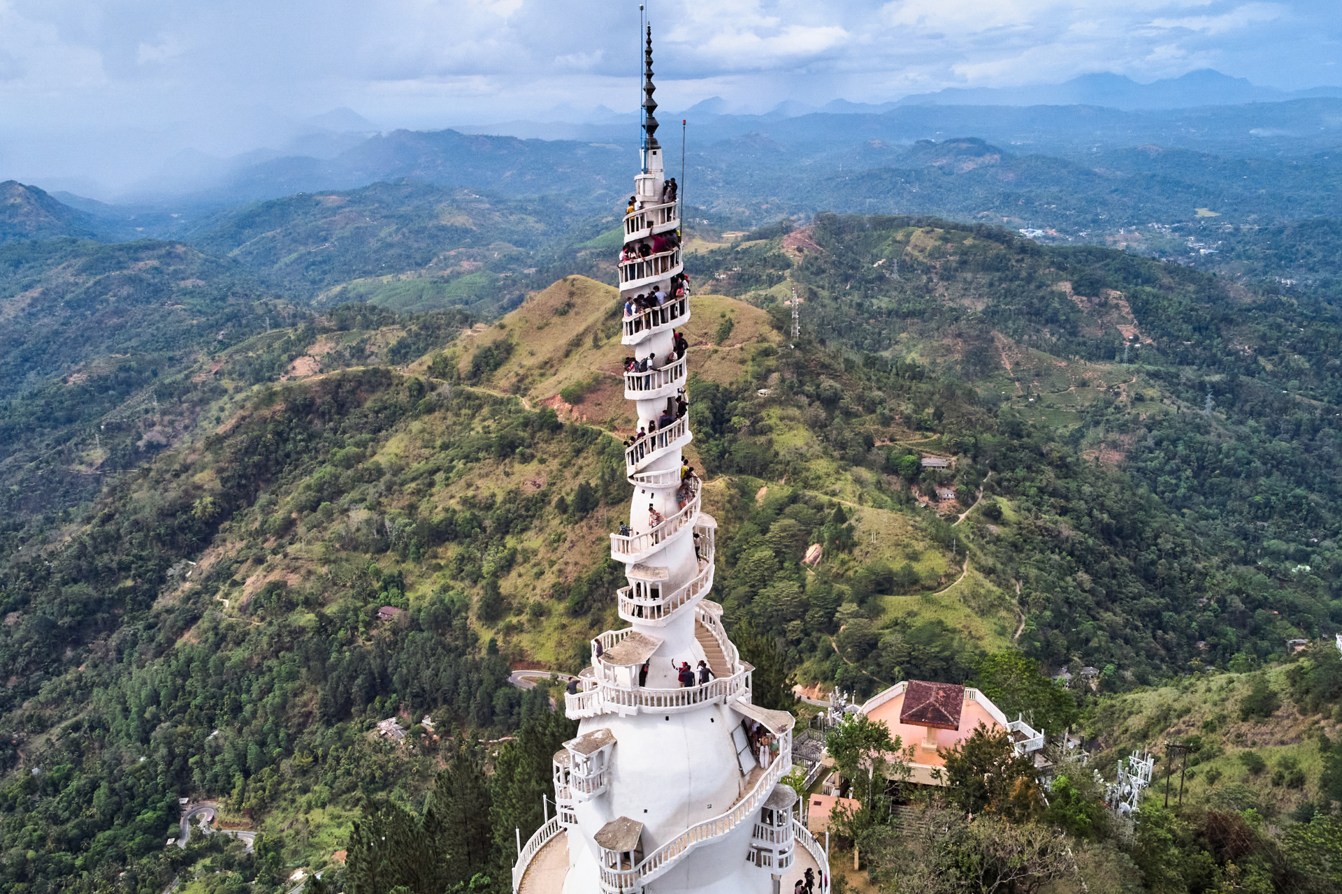
The area around is typically covered with thick patches of mist during early morning hours. But when the sun shines more, the surroundings get cleared, showing the special beauty of nature. It’s very windy at the top and the narrow cliff peak makes your heart beat as you look down you’ll understand how dangerous the slope is! You will catch a glimpse of other scenic spots in Kandy and elsewhere from this mountain peak. You’ll see the Pidurutalagala Mountain, Ambuluwawa Tower, Peacock Hills, Knuckles Mountain Range, Alagalla Mountain, etc., along with the towns like Gampola, Gelioya, Sarasawigama, University premises of Peradeniya, and Mahaweli River. Head off to Uragala, the highest peak of the Hanthana Mountain Range to catch more scenic views and more adventure.
Enjoy The Serenity…
Here you will be lost in a peaceful world away from the buzz and hustle of your daily life. You can sit on a large rock and enjoy your snacks and refresh before descending down the hill. Most of the time, you will also meet other hikers who are generally young students from the University of Peradeniya or traveler YouTubers.
Be friends with some of them so you can follow them down. Wait for the place to clear up so you can take some beautiful photos to add to your travel album. Take a walk around the hill and observe the flowers and plants, you’ll surely find beautiful, endemic plants!
When Is The Best Time to Hike Katusu Konda?
Missing the rainy season and hitting the peak during the drier season of the year is the best way to plan your hike to Katusu Konda. Rainfall in Sri Lanka in the past few years has been very unpredictable so we cannot specify a time of the year.
Nevertheless, generally, it rains heavily in Kandy during the period from May to August. You can therefore pick any time from January, February, and March or September through December to get through better. As recommended earlier, start the climb at 8.00 AM and get down preferably before 5 PM or sunset.
Things To Remember When Planning Your Hike to Katusu Konda Katusu Konda is a reserved area of the Hanthana Mountain Range which is also one of the most challenging hikes relative to regular mountains that you can hike in Sri Lanka. Therefore there are a few things you need to keep in mind when planning your hike.
Guide hike- You will need to take help from a tour guide because you are going to trek up to a very high mountain and you have better opportunities of getting lost there. Here there are also full of animals and dangerous areas so going with a guide will allow you to have a smoother ride. To get in touch with the services of a senior guide, you can contact the Explorers’ Club at the University of Peradeniya. We will leave the link below so that you can get their services to arrange a guide for your next hike.
• Pack the essentials in your backpack- Avoid filling your backpack as you have an extremely difficult trek to be undertaken. Pack accordingly with insect spray, food items, adequate water, rain poncho, leech repellent spray, painkiller balm/spray, etc.
• Wear a good pair of tightly gripping walking boots or shoes, thick socks, loose long apparel, and sunscreen.
• Please understand that this trek is for adventure-seeking hike lovers. So we won’t suggest you climb this summit while you are physically unsteady or on medication for some long-term illness.
• Children under the age of 12 years, senior citizens, and pregnant women shouldn’t attempt this trek either. It’s an ordeal that proves your physical stamina!
• Be quiet and patient during your ascent because you should not disturb or annoy the wildlife on this peak.
• Don’t forget to return with you what you brought. It is your duty to protect this natural site so that you may come again and enjoy its beauty. If you can, never bring polythene or plastic with you.
• Be watchful of the edges, slopes, and cliffs when you are at the top and especially when you have your recording gear with you. Once they go down, you will never be able to find them again!
• It is always advisable to start your trek before the sun rises at its peak and return before the sun sets.
Distance from Kandy – 14.1 km (40 minutes)
Katusu Konda is a summit found in the Hanthana Mountain Range of Kandy. It gets its name in relation to its resemblance in shape to the back of a lizard (Katussa).
The hike to Katudu Konda is not as tiring as climbing. Nevertheless, it is extremely windy at the top of the summit and also extremely narrow at the top.
The trek is an adventure tour and looking from the summit of the Katusu Konda slope is extremely steep slope. The adventure trekkers have an opportunity to witness very picturesque views at the summit of the Katusu Konda which consists of the Knuckles Mountain Range, University of Peradeniya, Kandy City, Monaragala, Alagalla and Hunnasgiriya.
By road travel from Kandy around 14 km through the Hantana-Uduwela Road to the summit of the Katusu Konda mountain in Kandy.
Arrival in Katusu Konda from Colombo
By taking the conventional forms of transport used in Sri Lanka, you are able to take private or public means to access Katusu Konda.
Alternatively, you can go by bus from the Fort bus station to Kandy or pre-book the train from the Fort railway station to Kandy. But if by bus, then you can drop off at Peradeniya and then travel further by Tuk-tuk to your destination (we will discuss the route along the foot of the peak till Peradeniya in the paragraphs below).
And, if you are traveling by train, you can disembark at the Sarasavi Uyana station and then take private means of transport to the site. Alternatively, take an off-road vehicle hire to gain direct access to the site. The choice of the means of transport is up to you and depending on your needs and budget.
Reaching Katusu Konda from Kandy
As has been suggested, it is simple to get to Katusu Konda if you are already in Kandy. Spending 45 minutes from Kandy to get to the mountain is all you require. Catch a bus from Kandy to Peradeniya and get to the base by tuk-tuk or a taxi.
But if you call a guide, you can also arrange an off-road vehicle to drive directly down to the base of the peak from wherever you are in Kandy. This will save your time and hence you will have enough time of day to take your hike and roam around.
Reaching the Peak from Peradeniya
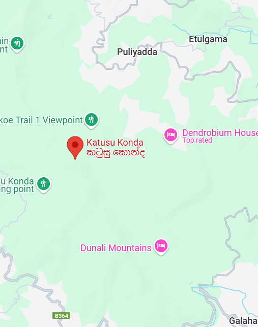
As soon as you reach Peradeniya, you will need to go up Galaha Road, go to Maha Kanda, go up to the village of Sarasawigama, and finally reach the Uplands Estate.
The most well-known walk up to the peak starts at this village. You will need to alight the vehicle at Sarasawigama and then trek from the Upland Estate.
You may park your car along the Hindu Kovil which is small, at Upland Estate and hike up along the path which drops through the row of small houses. You may buy food supplies you need from a shop at Sarasawigama village, which is the last one you will meet before completing the trek.
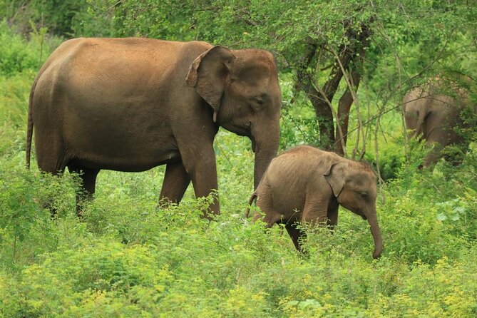
If you observe closely, you will find small arrows drawn on the stones by the previous climbers who have visited Katusu Konda. These arrows are of great help to you in finding the route, especially if you are climbing this mountain for the first time. During ascending, you will find animals like buffaloes, rabbits, and deers so you will have to climb silently not to frighten them in order to make your trek safer.
Map of Katusu Konda